|
Location:
Normandy/Brittany Border, France. |
Grid Reference:
48� 38' 10" N, 1� 30' 40" W |
 Mont St. Michel:
(Pilgrimage Site).
Mont St. Michel:
(Pilgrimage Site).
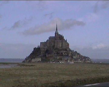
Rising to over 500 ft high, the Island of Mont St. Michel silhouettes the
sky creating a living work of art of gigantic proportions on a
canvas of sky, rock and sea. The site has remained a religious sanctuary
since at least the middle-ages, and became an important European pilgrimage
site (for Miquelots).
The island is composed of granite, along with
several others in the area, which stand out in what is generally
a low-lying country. (2)
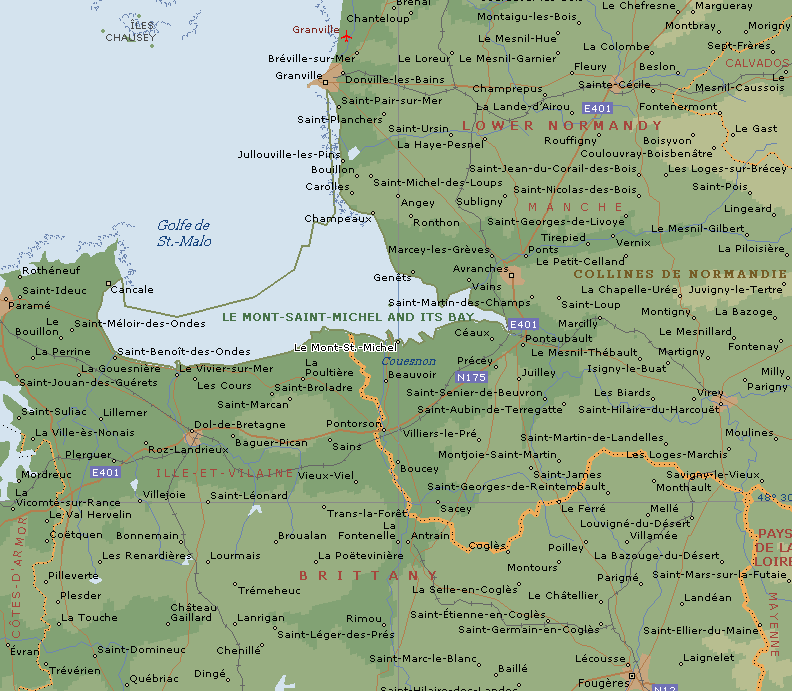
(Click here
for Map with location)
| Mont St.
Michel: (Previously 'Mont Tombe', 'Tomb Hill'). |
According to legend, an enormous tidal wave swept over the area,
transforming it completely at the beginning of the 8th century.
From the middle ages onwards, the island was dedicated to the worship of the
archangel Saint-Michael. In 708 AD, following
several visions, the Bishop Aubert sent messengers to Monte Gargano to
return with sacred objects (a piece of his red cloak, and a
fragment of the alter where he had placed his feet), in order to
sanctify the rock and its establishments.
(2).
Each century since then, the buildings have gained in size and
grandeur, reaching their present stature.
Archaeo-astronomy:
The main section of the structure is orientated at 26�
north of true-east (the same as that of the Notre Dame Cathedral in
Paris). This orientation can be followed in both directions creating an
alignment with Mont Dol to the SW (The place where St. Michael
is reputed to have fought
Lucifer), and to d'Avranches to the SE (The original home of Bishop Aubert,
to whom St. Michael appeared and ordered the rock dedicated in his
name).
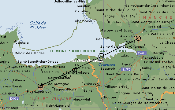
Dol Breton - Mont St. Michel - D'Avranches
Alignment. (Azimuth 26�)
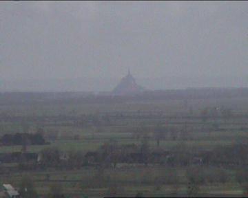
Mont St. Michel is clearly
visible on the horizon from the top of Mont Dol.
Alignments:
As
well as the alignment above, which is clearly solar in nature. Mont St.
Michel is also claimed to be aligned to several other sites dedicated to St. Michael. It
is said to run from
Mont Carmel in Israel (the rock of the prophet Eli), then passes through
Delos and Delphi (both oracle sites dedicated to Apollo), Corfu (where
Artemis, the sister of Apollo lived), Monte Gargano in Italy (the primary
European sanctuary of St. Michael and where he appeared several times), La
Sacra di San Michele in Pi�mont, the celebrated Benedictine monastery over
1000m high, Mont St. Michel in Normandy, Saint Michael's mount off the point
of Cornwall, and Skellig Michael, an island to the south of Ireland
(1).
This remarkable alignment is only visible on a Mercatorial map, suggesting a
knowledge of longitude and latitude.
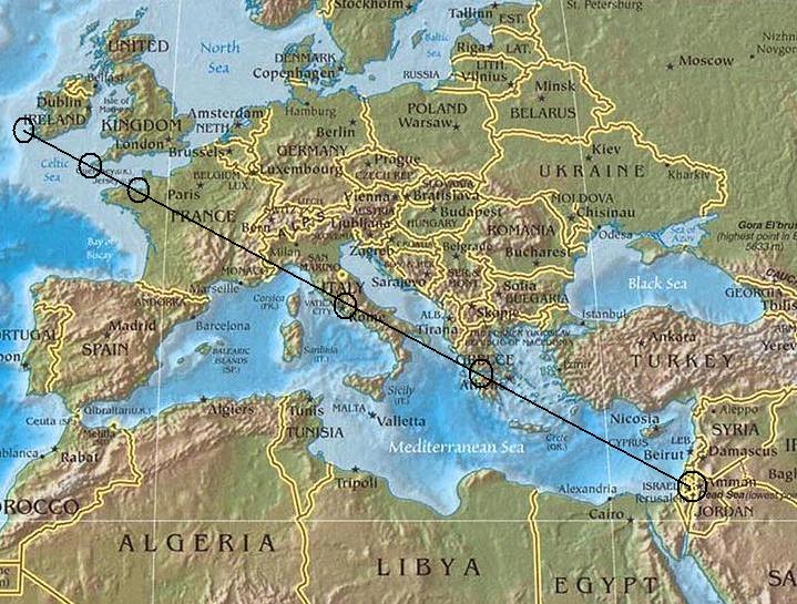
The European St. Michael's
Alignment.
It is a curious coincidence that
Mont St. Michel is situated exactly 7.5� South of
Glastonbury, (Also called
St. Michael's Mount), and which is both topped by the St.
Michaels chapel and lies on the St. Michael's ley. Glastonbury
is related to several other significant megalithic monuments in
Britain, both geometrically and in terms of longitude and
latitude.
(More about British Geodesy)
|